

Key Insights
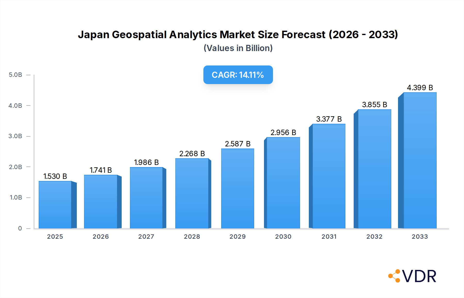
The Japan Geospatial Analytics Market is poised for significant expansion, projected to reach $1.53 Billion by 2025, fueled by a robust Compound Annual Growth Rate (CAGR) of 13.95% during the 2025-2033 forecast period. This substantial growth is attributed to the increasing adoption of geospatial analytics across a diverse range of industries, including government, defense, agriculture, and utilities. Key drivers include the escalating demand for location-based intelligence for improved decision-making, operational efficiency, and risk management. Furthermore, advancements in satellite imagery, IoT devices, and big data processing capabilities are creating new opportunities for sophisticated geospatial solutions. The market's trajectory is also influenced by government initiatives promoting smart city development and digital transformation, which inherently rely on accurate and comprehensive geospatial data.

Japan Geospatial Analytics Market Market Size (In Billion)
The market's expansion will be characterized by a deepening focus on advanced analytical techniques such as network analysis and geovisualization, moving beyond traditional surface analysis. End-user verticals like Automotive and Transportation, Real Estate and Construction, and Healthcare are increasingly recognizing the strategic value of geospatial data for optimizing logistics, site selection, and patient care. Despite strong growth, the market may encounter restraints such as data privacy concerns and the high cost of sophisticated geospatial software and hardware. However, the persistent need for actionable insights derived from spatial data, coupled with the continuous innovation from key players like ESRI, Hexagon AB, and Trimble, suggests a dynamic and promising future for the Japan Geospatial Analytics Market.
Japan Geospatial Analytics Market Company Market Share
This comprehensive report provides an in-depth analysis of the Japan Geospatial Analytics Market, offering critical insights into market dynamics, growth trends, key players, and emerging opportunities. Covering the study period from 2019–2033, with a base year of 2025, this report equips industry professionals with the data and strategic intelligence needed to navigate this rapidly evolving landscape. Explore the parent market's influence and delve into specific child markets, understanding how advancements in AI, cloud computing, and digital partnerships are reshaping the demand for sophisticated geospatial solutions.
Japan Geospatial Analytics Market Market Dynamics & Structure
The Japan Geospatial Analytics Market is characterized by a dynamic interplay of technological innovation, evolving regulatory frameworks, and distinct end-user demographics. Market concentration is moderately fragmented, with a few dominant players and a growing number of specialized providers vying for market share. Technological innovation drivers are primarily fueled by the increasing adoption of Artificial Intelligence (AI), Machine Learning (ML), and advanced data visualization techniques, enhancing the precision and applicability of geospatial analysis. Regulatory frameworks, while supportive of digital transformation, necessitate adherence to data privacy and security standards, influencing market entry and product development strategies. Competitive product substitutes are emerging in the form of integrated, end-to-end analytics platforms that offer a broader spectrum of capabilities beyond traditional geospatial tools.
- Market Concentration: Moderately fragmented, with key players like Alteryx, Hexagon AB, TomTom, Maxar Technologies, Trimble, ESRI, Caliper Corporation, General Electric, Bentley Systems Co, and Fugro holding significant influence.
- Technological Innovation Drivers: AI/ML integration, cloud-native solutions, real-time data processing, IoT data fusion, and advancements in satellite imagery and sensor technology.
- Regulatory Frameworks: Strict data privacy laws (e.g., APPI), government initiatives promoting digital transformation, and emerging standards for geospatial data interoperability.
- Competitive Product Substitutes: Integrated business intelligence platforms with geospatial capabilities, specialized industry software, and open-source geospatial libraries.
- End-User Demographics: Diverse, with significant demand from Government, Defense and Intelligence, Automotive and Transportation, and Utility and Communication sectors.
- M&A Trends: A growing trend of acquisitions aimed at expanding technological portfolios, acquiring niche market expertise, and consolidating market presence in high-growth segments. For instance, recent industry developments suggest increased investment in AI infrastructure, which could spur consolidation around companies offering AI-powered geospatial solutions.
Japan Geospatial Analytics Market Growth Trends & Insights
The Japan Geospatial Analytics Market is projected to experience robust growth, driven by an escalating demand for data-driven decision-making across various sectors. The market size evolution is marked by a consistent upward trajectory, with adoption rates for advanced geospatial analytics solutions accelerating. Technological disruptions, particularly the integration of AI and machine learning, are fundamentally altering how geospatial data is processed and interpreted, leading to more predictive and prescriptive analytics. Consumer behavior shifts are evident as businesses increasingly recognize the strategic imperative of leveraging location-based intelligence for operational efficiency, risk management, and customer engagement. The base year 2025 sets a crucial benchmark for understanding current market penetration, with forecasts indicating a significant Compound Annual Growth Rate (CAGR) from 2025 to 2033. This growth is intrinsically linked to the increasing pervasiveness of digital technologies and the growing volume of location-enabled data being generated. The government's push for digital transformation, coupled with private sector investments in advanced computing infrastructure, further fuels this expansion.
The integration of AI and machine learning algorithms with geospatial data is unlocking new levels of insight, moving beyond descriptive analytics to predictive and prescriptive models. This is particularly relevant for sectors like smart cities, autonomous vehicles, and disaster management, where real-time insights and predictive capabilities are paramount. The increasing availability of high-resolution satellite imagery, drone data, and IoT sensor data is providing richer and more granular datasets, demanding sophisticated analytical tools to derive meaningful intelligence. Furthermore, the development of user-friendly, cloud-based geospatial platforms is lowering the barrier to entry for small and medium-sized enterprises (SMEs), thereby broadening the market's reach. The growing emphasis on sustainability and resource management is also driving the adoption of geospatial analytics for applications such as precision agriculture, environmental monitoring, and urban planning. The evolution of 5G networks and edge computing will further enhance the capabilities of real-time geospatial analysis, enabling faster processing of vast datasets closer to the source. This pervasive technological advancement is expected to translate into higher market penetration across all end-user verticals.
Dominant Regions, Countries, or Segments in Japan Geospatial Analytics Market
The Japan Geospatial Analytics Market exhibits dominance across several key segments and end-user verticals, driven by specific economic policies, infrastructure development, and strategic priorities. Within the Type segment, Surface Analysis and Network Analysis are currently leading growth, owing to their direct applicability in urban planning, infrastructure management, and logistics optimization. These analyses provide critical insights into terrain, land use, and connectivity, which are essential for Japan's densely populated and highly developed urban centers. Geovisualization, while a supporting element, is gaining traction as a means to communicate complex geospatial insights effectively to a wider audience.
In terms of End-user Verticals, the Government sector plays a pivotal role, driven by initiatives focused on smart city development, disaster preparedness, and public infrastructure modernization. The Automotive and Transportation sector is another significant growth engine, fueled by the development of autonomous driving technologies, intelligent transportation systems, and advanced logistics. The increasing investment in electric vehicle (EV) infrastructure and smart mobility solutions further amplifies the demand for precise geospatial analytics. The Utility and Communication sector also demonstrates strong adoption, leveraging geospatial analytics for network planning, maintenance, and optimization of essential services. The Defense and Intelligence sector continues to be a substantial consumer, relying on geospatial intelligence for surveillance, reconnaissance, and strategic planning.
The Real Estate and Construction sector benefits from geospatial analytics for site selection, environmental impact assessments, and project management. Mining and Natural Resources, though a smaller segment in Japan compared to other regions, utilizes geospatial tools for exploration and resource management. Agricultural applications are growing, particularly in precision agriculture for optimizing crop yields and resource allocation. The overall dominance is a result of a confluence of factors including:
- Economic Policies: Government support for digital transformation and infrastructure upgrades directly benefits the adoption of geospatial solutions.
- Infrastructure: Japan's advanced urban infrastructure and interconnected transportation networks create a strong demand for network and surface analysis.
- Technological Readiness: A high level of technological adoption and innovation within Japanese industries fosters the integration of sophisticated geospatial analytics.
- Data Availability: The increasing availability of diverse geospatial data sources, from satellite imagery to IoT sensor data, supports complex analyses.
Market share in these dominant segments is influenced by the ability of solutions to provide real-time insights, integrate with existing enterprise systems, and offer scalable and cost-effective deployment models. The growth potential in these areas remains substantial as new applications and technological advancements continue to emerge.
Japan Geospatial Analytics Market Product Landscape
The product landscape within the Japan Geospatial Analytics Market is characterized by a rapid evolution of sophisticated software and platforms. Key innovations focus on enhancing the integration of AI and machine learning for predictive modeling, automating complex analytical workflows, and enabling real-time data processing from diverse sources like IoT sensors and high-resolution imagery. Companies are developing end-to-end solutions that streamline the entire geospatial analytics pipeline, from data ingestion and processing to analysis and visualization. Performance metrics are increasingly centered on accuracy, speed, scalability, and ease of integration with existing enterprise systems. Unique selling propositions often lie in specialized algorithms for specific industries, advanced visualization capabilities for intuitive understanding, and robust support for various geospatial data formats.
Key Drivers, Barriers & Challenges in Japan Geospatial Analytics Market
Key Drivers: The Japan Geospatial Analytics Market is propelled by several key drivers. The escalating need for data-driven decision-making across industries, coupled with the growing volume of location-enabled data, is a primary catalyst. Government initiatives promoting digital transformation, smart city development, and disaster preparedness create significant demand. The advancement of AI and machine learning capabilities is enabling more sophisticated and predictive geospatial analyses. Furthermore, the increasing adoption of IoT devices and the subsequent generation of real-time spatial data are fueling the need for advanced analytics platforms. The automotive sector's push towards autonomous driving and intelligent transportation systems is a significant driver for advanced location-based intelligence.
Barriers & Challenges: Despite the strong growth potential, the market faces several barriers and challenges. High implementation costs and the need for specialized skilled personnel can be a constraint, particularly for small and medium-sized enterprises. Data integration complexities, especially with legacy systems, pose technical hurdles. Stringent data privacy regulations, while essential, can sometimes create compliance burdens and limit data sharing. Intense competition from established global players and emerging local innovators necessitates continuous product development and differentiation. Supply chain issues for hardware components, though less pronounced for software-centric analytics, can indirectly impact deployment timelines. Regulatory hurdles related to data ownership and usage for certain sensitive applications also present challenges.
Emerging Opportunities in Japan Geospatial Analytics Market
Emerging opportunities in the Japan Geospatial Analytics Market are abundant and diverse. The burgeoning field of smart city development presents immense potential for integrated geospatial solutions in traffic management, resource allocation, and public safety. The growing focus on sustainability and climate change adaptation is driving demand for geospatial analytics in environmental monitoring, disaster risk assessment, and resilient infrastructure planning. The expansion of 5G networks and edge computing infrastructure will unlock new possibilities for real-time, location-aware applications, particularly in the autonomous vehicle and IoT domains. Untapped markets exist within niche industrial applications and the healthcare sector for optimizing patient care and resource distribution. Evolving consumer preferences for personalized services and experiences also create opportunities for location-based marketing and service delivery.
Growth Accelerators in the Japan Geospatial Analytics Market Industry
Several catalysts are accelerating growth within the Japan Geospatial Analytics Market. Technological breakthroughs, such as advancements in AI-powered image recognition and predictive modeling, are enhancing the capabilities and applicability of geospatial analytics. Strategic partnerships between technology providers, data vendors, and industry-specific solution developers are fostering innovation and expanding market reach. The increasing government investment in digital infrastructure and R&D for emerging technologies like AI and quantum computing directly supports the evolution of geospatial tools. Market expansion strategies, including the development of tailored solutions for specific industry needs and the increasing accessibility of cloud-based platforms, are broadening the customer base. The emphasis on data-driven decision-making across all sectors is creating a sustained demand for the insights that geospatial analytics provide.
Key Players Shaping the Japan Geospatial Analytics Market Market
- Alteryx
- Hexagon AB
- TomTom
- Maxar Technologies
- Trimble
- ESRI
- Caliper Corporation
- General Electric
- Bentley Systems Co
- Fugro
Notable Milestones in Japan Geospatial Analytics Market Sector
- April 2024: Microsoft announced a significant investment of USD 2.9 billion over the next two years to enhance its hyperscale cloud computing and AI infrastructure in Japan. The company will also expand its digital skilling programs to provide AI training to over 3 million individuals within the next three years. This investment is poised to significantly boost the development and adoption of AI-driven geospatial analytics tools.
- May 2024: The European Union and Japan began their Digital Partnership, reviewing the progress made since the first Digital Partnership Council in 2023. The partners agreed on new deliverables to enhance cooperation on critical digital technologies. These include artificial intelligence (AI), 5G to 6G advancements, semiconductors, high-performance computing (HPC), quantum technology, submarine cables, eID, and cybersecurity. This collaboration is expected to foster cross-border innovation and drive advancements in geospatial data sharing and analysis technologies.
- These technological advancements are poised to drive the evolution of geospatial analytics tools and technologies, leading to enhanced capabilities in data processing, analysis, and application across various industries.
In-Depth Japan Geospatial Analytics Market Market Outlook
The Japan Geospatial Analytics Market is on a robust growth trajectory, underpinned by continuous technological advancements and strategic market expansions. Growth accelerators such as the pervasive integration of AI and machine learning, coupled with the proliferation of IoT devices, are empowering more sophisticated and predictive geospatial insights. Strategic partnerships between key industry players are fostering innovation and enabling the development of tailored solutions for diverse end-user verticals, from smart cities to autonomous transportation. The Japanese government's commitment to digital transformation and its investments in advanced computing infrastructure provide a fertile ground for market expansion. The increasing demand for data-driven decision-making across all sectors, alongside evolving consumer preferences, will continue to fuel the adoption of geospatial analytics, promising a future of enhanced spatial intelligence and operational efficiency.
Japan Geospatial Analytics Market Segmentation
-
1. Type
- 1.1. Surface Analysis
- 1.2. Network Analysis
- 1.3. Geovisualization
-
2. End-user Vertical
- 2.1. Agricultural
- 2.2. Utility and Communication
- 2.3. Defense and Intelligence
- 2.4. Government
- 2.5. Mining and Natural Resources
- 2.6. Automotive and Transportation
- 2.7. Healthcare
- 2.8. Real Estate and Construction
- 2.9. Other End-user Verticals
Japan Geospatial Analytics Market Segmentation By Geography
- 1. Japan
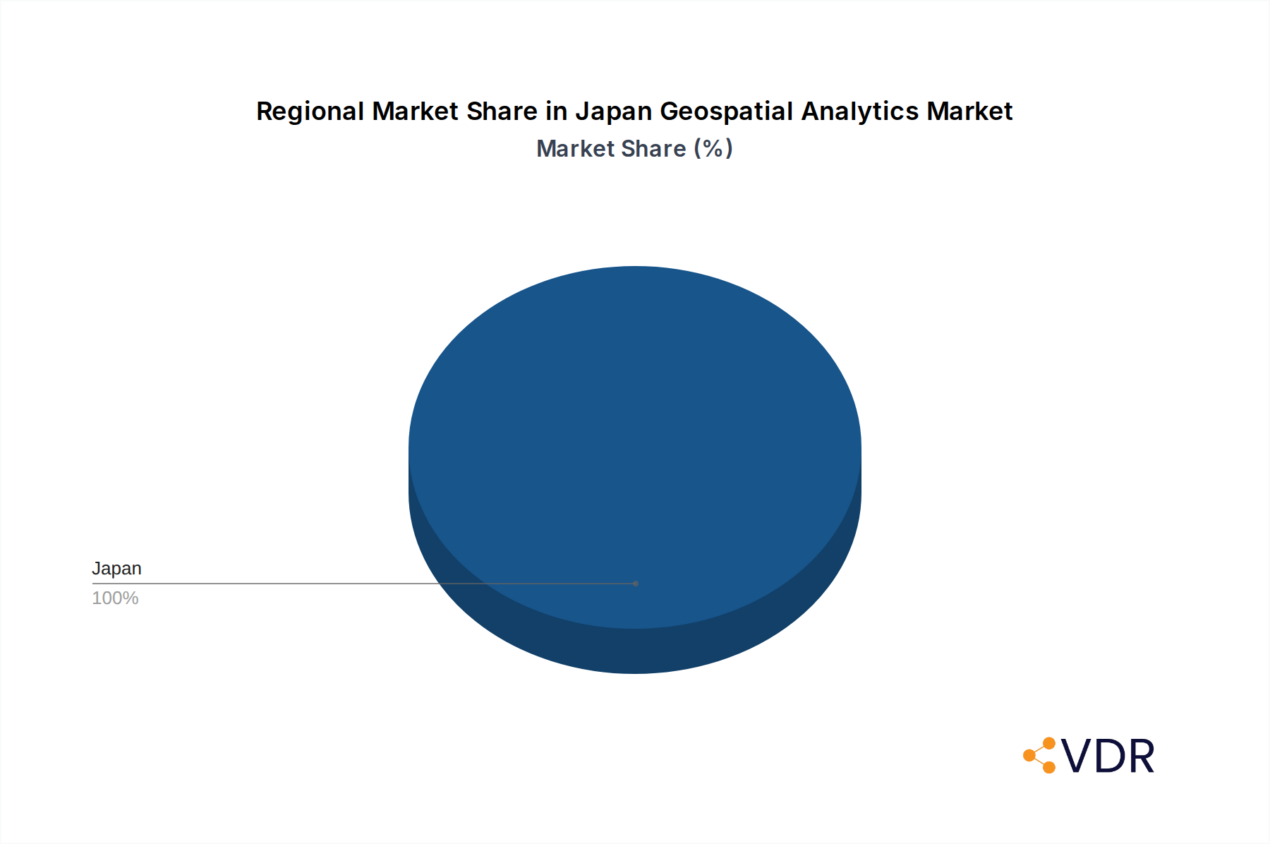
Japan Geospatial Analytics Market Regional Market Share
Geographic Coverage of Japan Geospatial Analytics Market
Japan Geospatial Analytics Market REPORT HIGHLIGHTS
| Aspects | Details |
|---|---|
| Study Period | 2020-2034 |
| Base Year | 2025 |
| Estimated Year | 2026 |
| Forecast Period | 2026-2034 |
| Historical Period | 2020-2025 |
| Growth Rate | CAGR of 13.95% from 2020-2034 |
| Segmentation |
|
Table of Contents
- 1. Introduction
- 1.1. Research Scope
- 1.2. Market Segmentation
- 1.3. Research Objective
- 1.4. Definitions and Assumptions
- 2. Executive Summary
- 2.1. Market Snapshot
- 3. Market Dynamics
- 3.1. Market Drivers
- 3.2. Market Restrains
- 3.3. Market Trends
- 3.4. Market Opportunities
- 4. Market Factor Analysis
- 4.1. Porters Five Forces
- 4.1.1. Bargaining Power of Suppliers
- 4.1.2. Bargaining Power of Buyers
- 4.1.3. Threat of New Entrants
- 4.1.4. Threat of Substitutes
- 4.1.5. Competitive Rivalry
- 4.2. PESTEL analysis
- 4.3. BCG Analysis
- 4.3.1. Stars (High Growth, High Market Share)
- 4.3.2. Cash Cows (Low Growth, High Market Share)
- 4.3.3. Question Mark (High Growth, Low Market Share)
- 4.3.4. Dogs (Low Growth, Low Market Share)
- 4.4. Ansoff Matrix Analysis
- 4.5. Supply Chain Analysis
- 4.6. Regulatory Landscape
- 4.7. Current Market Potential and Opportunity Assessment (TAM–SAM–SOM Framework)
- 4.8. VDR Analyst Note
- 4.1. Porters Five Forces
- 5. Market Analysis, Insights and Forecast 2021-2033
- 5.1. Market Analysis, Insights and Forecast - by Type
- 5.1.1. Surface Analysis
- 5.1.2. Network Analysis
- 5.1.3. Geovisualization
- 5.2. Market Analysis, Insights and Forecast - by End-user Vertical
- 5.2.1. Agricultural
- 5.2.2. Utility and Communication
- 5.2.3. Defense and Intelligence
- 5.2.4. Government
- 5.2.5. Mining and Natural Resources
- 5.2.6. Automotive and Transportation
- 5.2.7. Healthcare
- 5.2.8. Real Estate and Construction
- 5.2.9. Other End-user Verticals
- 5.3. Market Analysis, Insights and Forecast - by Region
- 5.3.1. Japan
- 5.1. Market Analysis, Insights and Forecast - by Type
- 6. Japan Geospatial Analytics Market Analysis, Insights and Forecast, 2021-2033
- 6.1. Market Analysis, Insights and Forecast - by Type
- 6.1.1. Surface Analysis
- 6.1.2. Network Analysis
- 6.1.3. Geovisualization
- 6.2. Market Analysis, Insights and Forecast - by End-user Vertical
- 6.2.1. Agricultural
- 6.2.2. Utility and Communication
- 6.2.3. Defense and Intelligence
- 6.2.4. Government
- 6.2.5. Mining and Natural Resources
- 6.2.6. Automotive and Transportation
- 6.2.7. Healthcare
- 6.2.8. Real Estate and Construction
- 6.2.9. Other End-user Verticals
- 6.1. Market Analysis, Insights and Forecast - by Type
- 7. Competitive Analysis
- 7.1. Company Profiles
- 7.1.1 Alteryx
- 7.1.1.1. Company Overview
- 7.1.1.2. Products
- 7.1.1.3. Company Financials
- 7.1.1.4. SWOT Analysis
- 7.1.2 Hexagon AB
- 7.1.2.1. Company Overview
- 7.1.2.2. Products
- 7.1.2.3. Company Financials
- 7.1.2.4. SWOT Analysis
- 7.1.3 TomTom
- 7.1.3.1. Company Overview
- 7.1.3.2. Products
- 7.1.3.3. Company Financials
- 7.1.3.4. SWOT Analysis
- 7.1.4 Maxar Technologies
- 7.1.4.1. Company Overview
- 7.1.4.2. Products
- 7.1.4.3. Company Financials
- 7.1.4.4. SWOT Analysis
- 7.1.5 Trimble
- 7.1.5.1. Company Overview
- 7.1.5.2. Products
- 7.1.5.3. Company Financials
- 7.1.5.4. SWOT Analysis
- 7.1.6 ESRI
- 7.1.6.1. Company Overview
- 7.1.6.2. Products
- 7.1.6.3. Company Financials
- 7.1.6.4. SWOT Analysis
- 7.1.7 Caliper Corporation
- 7.1.7.1. Company Overview
- 7.1.7.2. Products
- 7.1.7.3. Company Financials
- 7.1.7.4. SWOT Analysis
- 7.1.8 General Electric
- 7.1.8.1. Company Overview
- 7.1.8.2. Products
- 7.1.8.3. Company Financials
- 7.1.8.4. SWOT Analysis
- 7.1.9 Bentley Systems Co
- 7.1.9.1. Company Overview
- 7.1.9.2. Products
- 7.1.9.3. Company Financials
- 7.1.9.4. SWOT Analysis
- 7.1.10 Fugr
- 7.1.10.1. Company Overview
- 7.1.10.2. Products
- 7.1.10.3. Company Financials
- 7.1.10.4. SWOT Analysis
- 7.1.1 Alteryx
- 7.2. Market Entropy
- 7.2.1 Company's Key Areas Served
- 7.2.2 Recent Developments
- 7.3. Company Market Share Analysis 2025
- 7.3.1 Top 5 Companies Market Share Analysis
- 7.3.2 Top 3 Companies Market Share Analysis
- 7.4. List of Potential Customers
- 8. Research Methodology
List of Figures
- Figure 1: Japan Geospatial Analytics Market Revenue Breakdown (Million, %) by Product 2025 & 2033
- Figure 2: Japan Geospatial Analytics Market Share (%) by Company 2025
List of Tables
- Table 1: Japan Geospatial Analytics Market Revenue Million Forecast, by Type 2020 & 2033
- Table 2: Japan Geospatial Analytics Market Volume Billion Forecast, by Type 2020 & 2033
- Table 3: Japan Geospatial Analytics Market Revenue Million Forecast, by End-user Vertical 2020 & 2033
- Table 4: Japan Geospatial Analytics Market Volume Billion Forecast, by End-user Vertical 2020 & 2033
- Table 5: Japan Geospatial Analytics Market Revenue Million Forecast, by Region 2020 & 2033
- Table 6: Japan Geospatial Analytics Market Volume Billion Forecast, by Region 2020 & 2033
- Table 7: Japan Geospatial Analytics Market Revenue Million Forecast, by Type 2020 & 2033
- Table 8: Japan Geospatial Analytics Market Volume Billion Forecast, by Type 2020 & 2033
- Table 9: Japan Geospatial Analytics Market Revenue Million Forecast, by End-user Vertical 2020 & 2033
- Table 10: Japan Geospatial Analytics Market Volume Billion Forecast, by End-user Vertical 2020 & 2033
- Table 11: Japan Geospatial Analytics Market Revenue Million Forecast, by Country 2020 & 2033
- Table 12: Japan Geospatial Analytics Market Volume Billion Forecast, by Country 2020 & 2033
Frequently Asked Questions
1. What is the projected Compound Annual Growth Rate (CAGR) of the Japan Geospatial Analytics Market?
The projected CAGR is approximately 13.95%.
2. Which companies are prominent players in the Japan Geospatial Analytics Market?
Key companies in the market include Alteryx, Hexagon AB, TomTom, Maxar Technologies, Trimble, ESRI, Caliper Corporation, General Electric, Bentley Systems Co, Fugr.
3. What are the main segments of the Japan Geospatial Analytics Market?
The market segments include Type, End-user Vertical.
4. Can you provide details about the market size?
The market size is estimated to be USD 1.53 Million as of 2022.
5. What are some drivers contributing to market growth?
Increase In Adoption of Smart City Development; Introduction of 5G to Boost Market Growth.
6. What are the notable trends driving market growth?
Disaster Risk Reduction and Management.
7. Are there any restraints impacting market growth?
Increase In Adoption of Smart City Development; Introduction of 5G to Boost Market Growth.
8. Can you provide examples of recent developments in the market?
April 2024: Microsoft announced a significant investment of USD 2.9 billion over the next two years to enhance its hyperscale cloud computing and AI infrastructure in Japan. The company will also expand its digital skilling programs to provide AI training to over 3 million individuals within the next three years.
9. What pricing options are available for accessing the report?
Pricing options include single-user, multi-user, and enterprise licenses priced at USD 3800, USD 4500, and USD 5800 respectively.
10. Is the market size provided in terms of value or volume?
The market size is provided in terms of value, measured in Million and volume, measured in Billion.
11. Are there any specific market keywords associated with the report?
Yes, the market keyword associated with the report is "Japan Geospatial Analytics Market," which aids in identifying and referencing the specific market segment covered.
12. How do I determine which pricing option suits my needs best?
The pricing options vary based on user requirements and access needs. Individual users may opt for single-user licenses, while businesses requiring broader access may choose multi-user or enterprise licenses for cost-effective access to the report.
13. Are there any additional resources or data provided in the Japan Geospatial Analytics Market report?
While the report offers comprehensive insights, it's advisable to review the specific contents or supplementary materials provided to ascertain if additional resources or data are available.
14. How can I stay updated on further developments or reports in the Japan Geospatial Analytics Market?
To stay informed about further developments, trends, and reports in the Japan Geospatial Analytics Market, consider subscribing to industry newsletters, following relevant companies and organizations, or regularly checking reputable industry news sources and publications.
Methodology
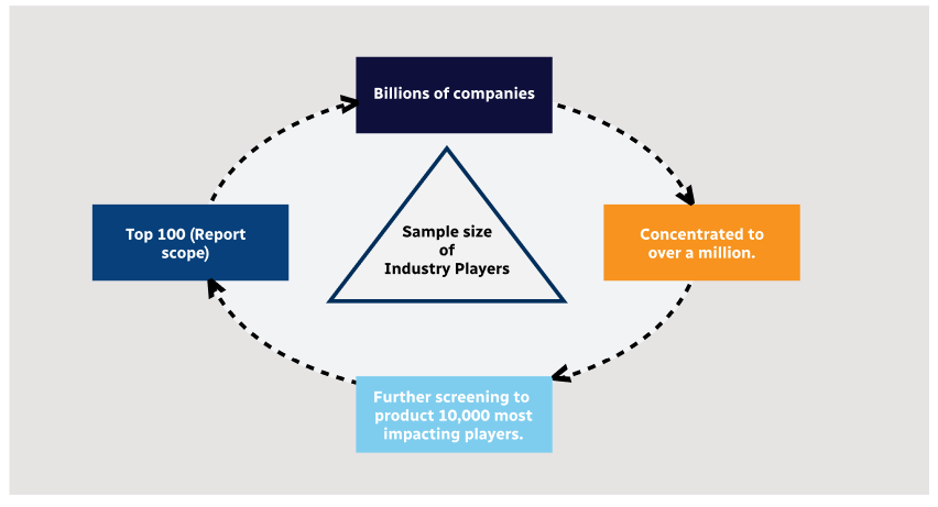
Step 1 - Identification of Relevant Samples Size from Population Database
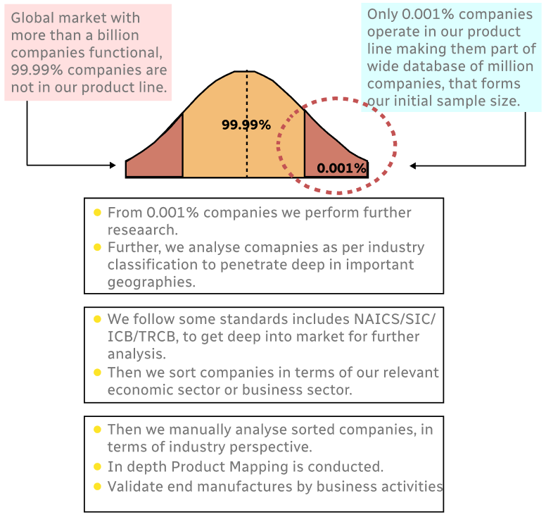
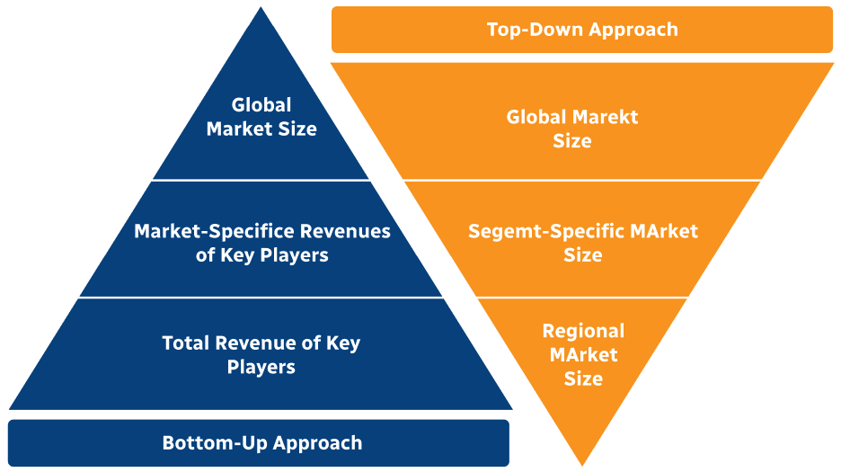
Step 2 - Approaches for Defining Global Market Size (Value, Volume* & Price*)
Note*: In applicable scenarios
Step 3 - Data Sources
Primary Research
- Web Analytics
- Survey Reports
- Research Institute
- Latest Research Reports
- Opinion Leaders
Secondary Research
- Annual Reports
- White Paper
- Latest Press Release
- Industry Association
- Paid Database
- Investor Presentations
Step 4 - Data Triangulation
Involves using different sources of information in order to increase the validity of a study
These sources are likely to be stakeholders in a program - participants, other researchers, program staff, other community members, and so on.
Then we put all data in single framework & apply various statistical tools to find out the dynamic on the market.
During the analysis stage, feedback from the stakeholder groups would be compared to determine areas of agreement as well as areas of divergence